A late-summer drive
Webster, Massachusetts
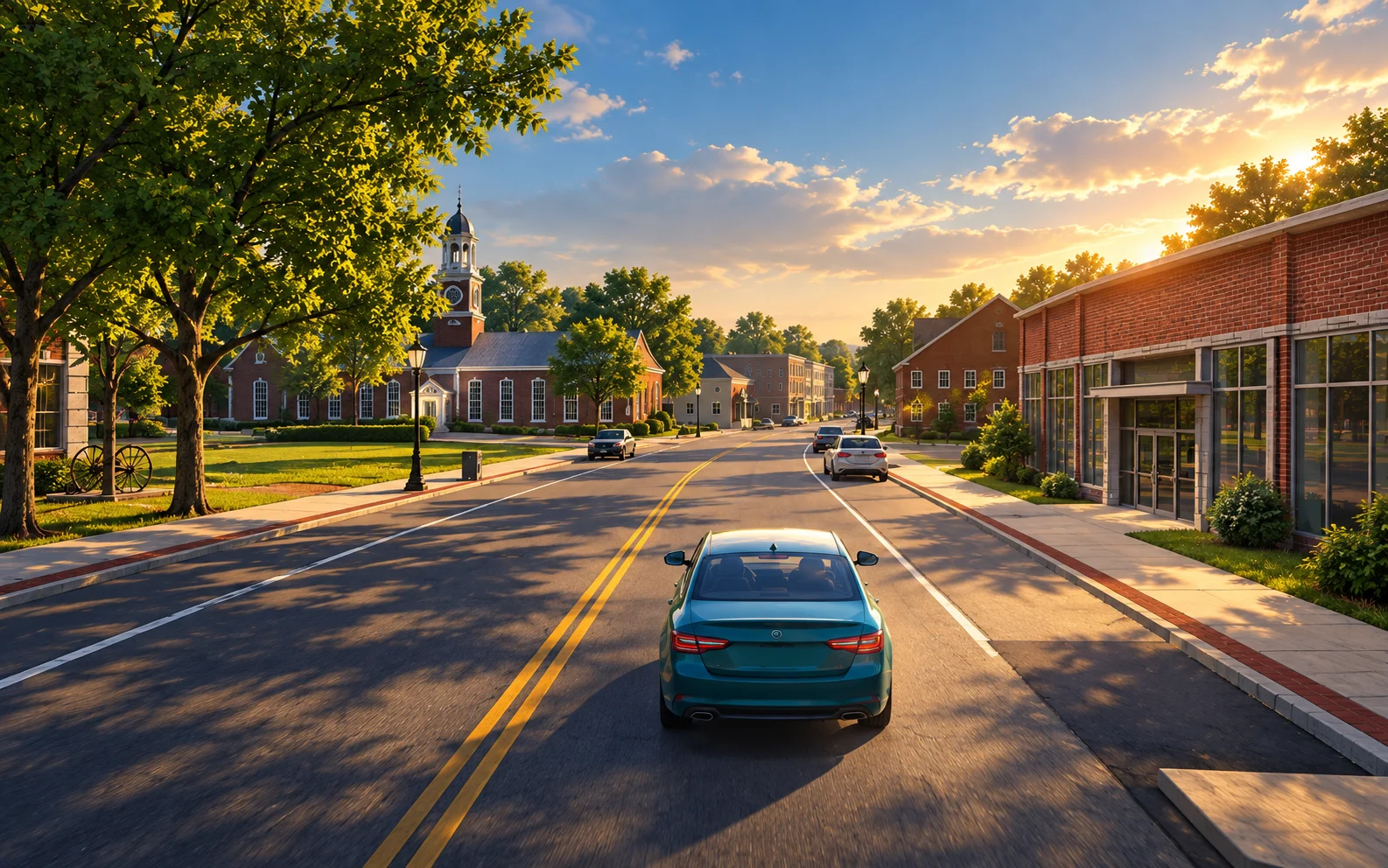
Webster Massachusetts Simulator
Drive the streets.
Step out, walk, or fly.
Arrow keys or touch · E to get out
Explore on foot. Drag the view to look around.
Continue on Main Street
Explore Webster
Choose a starting place, then take your own turns. Moving to another start resets this drive’s mileage; reloading offers your last saved road position, safely paused.
Brick storefronts, Town Hall and the French River mill district. Take the side streets and come back by a different turn.
Begin beside South Pond and explore the wooded residential roads around Webster Lake.
Visit the shoreline and the park approach. The mapped access turns around at its end.
Explore the campground access roads near the lake. These paths are unnamed in the road inventory; compass labels distinguish the branches.
Start near Bartlett and look for porches, triple-deckers and the quieter neighborhood streets.
A close look at the town’s residential architecture. Use the steady camera or stop anywhere to look around.
Places to look for
Select a place to see its part of town. These markers show scenery; use the six starting places above to move the car.
Scenery markers come from the game’s building, bridge and shoreline research. Nearby roads are references, not turn-by-turn directions.
Near Negus Street. Red brick civic building with a pale clock cupola, connected to the former school.
Near Lake Street. The modern library beside the civic green.
Near Memorial Drive. The museum building in the school and mill-town district.
Near Maynard Street. A landmark church with twin towers and a detailed front.
Near Lake Street. The modern church with its broad roof and separate bell feature.
Near East Main Street. The stone church and its prominent front towers.
Near Church Court. The church and nearby historic parish house.
Near Unnamed Road. The school campus and playing fields.
Near Unnamed Road. The neighboring school campus in the Bartlett district.
Near Unnamed Road. The elementary school campus and its grounds.
Near Mill Street. The surviving brick mill complex in North Village.
Near Maple Street. The industrial buildings beside the French River corridor.
Near Main Street. Main Street’s masonry crossing of the French River.
Near Memorial Beach Drive. The historic pony-truss footbridge, visible beside the road network.
Near Unnamed Road. The paddleboat at the Indian Ranch waterfront. Its berth is a fixed game interpretation.
Near South Main Street. The commemorative brick court beside Town Hall.
An unhurried guided drive: cruise does not simulate traffic or enforce stops. Turn around is an instant game assist. Some routes stop at the edge of the mapped town.
This copies a local text report. Nothing is sent automatically.
Webster Car radio · AM / FM Off
Off
Internet receiverStation guide
Live internet radio · Simulated static
Checked
Ready when you are.
How to drive and explore
- ↑ ↓
- Cruise at the road limit / brake
- ← →
- Choose a turn at a junction
- Esc P
- Esc pauses; P pauses / resumes. Space also pauses / resumes while driving
- R
- Instantly turn around
- C
- Change camera
- S
- Clear a pending turn and follow the road where possible
- M
- Silence all driving sound and radio
- 1–6
- Move to the corresponding starting place; resets this drive
- E
- Get out, or enter the car when you are close to it
- F
- Summon your car to the nearest safe street while on foot
- W A S D
- Move relative to the view while on foot; drag the town view to look around
- ↑ ↓ ← →
- On foot: walk forward / backward, or turn left / right
- Shift
- Hold to run on foot or boost your jetpack speed
- J
- Turn your jetpack on / off while on foot
- Space Q
- Hold to rise / descend with your jetpack
The car stays on the road. Press Up to accelerate smoothly to the road’s speed limit, including 65 mph on I-395. On entrance ramps, speed builds gradually toward the highway limit before merging. Pick a direction as you approach a junction, or click a labeled road option to select that exact branch. Turn around instantly with the button or R. On a touch screen, use the arrows below the road.
Click the town view to use the keyboard. Tab leaves the driving view for the controls. Leaving the game pauses the drive. Use Resume or Up to continue. Braking reduces your cruise target; press Up again to return to the road limit. Once a turn begins, a new choice applies to the following junction.
Choose Get out to explore on foot. Drag the view to look around, then walk with W A S D or use the touch arrows. Hold Shift or Run / boost to run on the ground or fly faster. Enable the jetpack to fly up to 1,000 metres above the ground; hold Space or Rise to climb, and Q or Down to descend. Release thrust to hover, or press J to switch the jetpack off and land. Over water, the jetpack keeps you hovering; fly to shore to land. Choose Enter car when you are nearby, or Summon car to bring it to the nearest safe street.
Sound starts only if you turn it on. Pause stops driving sound and leaves the radio available; M or Mute all sound silences both. Radio turns off when you leave the tab. The road limit may be an estimate where the road inventory has no posted value; a ramp target is modeled acceleration toward the highway limit.
Automatic detail can reduce resolution and shadows to keep the drive responsive. Choose a detail setting again to restore its starting quality. The saved camera, comfort, detail and volume settings return on your next visit; sound still starts off.
A reconstruction of a real place, with room for interpretation.
About the town and its sources
This town combines mapped roads, building footprints, aerial imagery, and lidar with modeled architecture and vegetation. Its summer palette, materials and light are designed to capture Webster’s character as a driving game.
- The ground and buildings
- MassGIS mapping and spring 2025 aerial imagery establish the town’s layout. USGS lidar collected in 2021 supplies much of its height and roof information.
- The streets
- The driving network follows mapped roads, with MassDOT road information informing their appearance. The car follows a guided path with simplified turns. Classified lidar returns establish the Main Street bridge deck height; bridge structures combine published span and construction records with modeled finishes. Railroad-crossing gates and light masts follow the federal inventory, with authored hardware placement.
- The architecture
- 5,031 residential profiles use mapped footprints, assessor styles, story counts and elevation evidence. Roofs, chimneys and eaves on 5,008 of them are fitted to the 2021 lidar, its returns shifted onto each mapped footprint; the town assessor’s street photographs supply siding, trim, shutter and door colors, porches and their roofs, posts and railings, where the doors, windows, dormers and garage doors stand, door hoods and porticos, awnings, bay windows, decks, outside stairs, solar panels, mailboxes, planting and front fences for 4,775, and whether each street has a painted center line and which side its poles stand on. 1,239 garages, sheds and other buildings are fitted to the lidar the same way, and 1,192 more keep their inferred shapes with doors facing their drives. Dated property descriptions inform 121 of those homes; historical inventory descriptions guide materials and frontage treatments for 127 profiles. Sacred Heart, First Baptist, St. Louis, St. Joseph, Reconciliation, the Kelly Library, the Samuel Slater Experience and the fire station have individually composed building forms. Town Hall and the former school have source-fitted window bays and pale trim. The schools, police and post office use separately composed masses and entrances. Main Street blocks and mill façades use dated architectural records, parcel divisions and roof evidence; ordinary shops and garages have inferred storefront details. Selected landmarks and eleven School Street properties also use public exterior photographs. Other roof shapes, opening dimensions, hidden elevations and unrecorded finishes remain interpretations. Historic descriptions and older paint colors are references; present appearance may differ.
- The horizon
- USGS 3DEP elevations shape the surrounding hills at their real heights. The skyline changes with your position and altitude, including Earth curvature. Beyond the detailed town, 2025 Annual NLCD land-cover and canopy estimates guide forest, field and water patterns. Representative forest clusters gradually blend into simpler distant cover. Their shapes, heights and summer colors are artistic choices, not individually surveyed trees; haze and clouds are also authored. Atmospheric refraction and current weather are not simulated.
- The season
- Late-summer grass, foliage, light, and finishes are artistic choices. MassGIS 2016 land cover distinguishes lawns, woods, and paved areas, with mapped roads, buildings, and water refining their boundaries. Near the streets and houses, trees stand where the 2021 lidar found their crowns, at their measured heights and spreads; farther out, woods are grouped canopy. Each tree is drawn as an evergreen or a broadleaf by what the 2025 leaf-off aerial shows at its crown; individual species are not surveyed. Grass beneath trees near homes is inferred as lawn. Sources come from different dates, so some buildings and streets may differ from Webster today.
- Parking and ground finishes
- Reviewed OpenStreetMap outlines and spring 2025 MassGIS aerial views refine paved lots and selected driveways. Parking bay layouts are composed for the game within those boundaries; they do not reproduce surveyed stall counts or accessible-space assignments. Continuous road markings, pavement edges and woodland-floor materials include modeled finishing choices.
- People in the town
- The pedestrians are animated characters authored for the game. They do not represent real people or their movements.
- The railway
- The Norwich Branch follows its active mapped route through town, including the river crossings and the passage beneath Mill Street. OpenStreetMap supplies the alignment and standard gauge; MassGIS and federal crossing records distinguish the active line and road crossings. Rail elevations are fitted to the modeled terrain and road surfaces. Ballast, ties, rail profiles and bridge construction are interpretations, not a railway engineering survey.
- Bridges, memorials and shorelines
- Historical surveys guide Memorial Beach’s iron truss and sidewalk posts. The Court of Honor, lawn howitzers, relocated Slater markers and other public memorials use dated records and photographs; small dimensions and placements remain interpretations. Cemetery stones, shoreline plants and dam fragments sit within mapped settings, with anonymous layouts and inferred details. Memorial Beach has its documented double launch and 65-foot flagpole; the DCR Lakeside launch has a single concrete strip with a locally registered water edge. The Indian Princess uses its photographed two-deck riverboat appearance and a berth visible in 2025 imagery; it is a stationary interpretation.
- Roadside details
- WRTA boarding-stop coordinates locate bus flags; OpenStreetMap records locate collection boxes. Stop signs and traffic lights combine OpenStreetMap controls with MassDOT sign assets and intersection-control records, retrieved September 2026. Road approaches, roadside offsets and signal hardware are modeled where the records do not survey them. Signal colors follow simplified game timing, not real controller programs. The inventories are incomplete and include older surveys; construction changes and unmapped controls may differ today. Flag and box designs and pole hardware are modeled interpretations. Selected overhead utility runs follow photographed corridor character, with inferred spacing and placement; they are not a surveyed utility map. Matched road-inventory segments distinguish earth, gravel and surface-treated pavement using inferred material tones. The Gore Road plaza’s lake-name sign uses a dated exterior reference. Playing fields and solar-site boundaries receive restrained inferred equipment. Nine aerial-registered wastewater basins preserve the surrounding real buildings; rails and small dimensions are authored.
Architectural notes and selected public exterior images guide the modeled buildings. Materials include public-domain textures from Poly Haven and ambientCG. Traffic lights follow a simplified game cycle; guided driving does not enforce signals or stop signs.
MassGIS© OpenStreetMap contributorsUSGS 3D Elevation ProgramMassDOTMassachusetts historical inventoryHistoric American Engineering RecordRailroad crossing inventoryWRTAPoly Haven licenseambientCG license